
¡Bienvenidos!

| How to get to the beach |
|
|
¡Bienvenidos!
|
||||
|
|
|||||
|
|||||
 |
20
minutes
|
12
miles
|
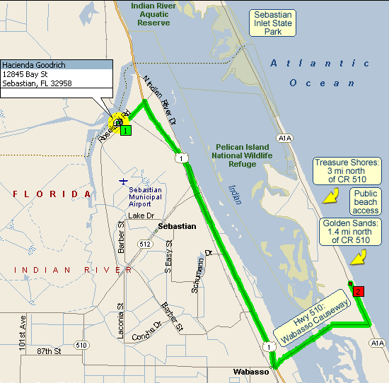
The fastest way to the beach is by car. After crossing over the Wabasso Causeway to the barrier island (about 8 miles south of the Sebastian River), you can turn right or left to reach several public beach access points. See map for exact directions |
|
30 minutes |
3.5
miles
|
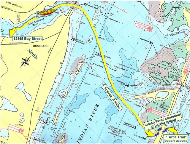
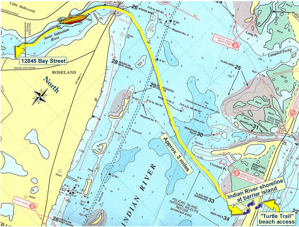
If you have the use of a boat, the most direct (and enjoyable) way to reach the beach is to travel by boat to the east side of the Indian River Lagoon (not through the Inlet to the ocean!), and then walk across the island at one of its narrowest points. Tie up at the river shoreline near the point indicated on the map (choose one below), walk across highway A1A (generally not a very busy highway), and use the "Turtle Trail" beach access trail to walk over to the beach. Boats are available for rent at several area marinas. See the medium, larger, or extra-large version of the nautical map for a suggested route (map is marked with navigational markers and water depth, in feet). This route places you on the beach very near the point where the survivors of the shipwrecked fleet of 1715 (arguably the first European settlers of what would later become Sebastian) were washed ashore. Maybe you'll find some of their lost treasure washed up on the beach.... |
|
|
History | Satellite
| Photo tour 1 pg a • b | Photo
tour 2 pg a •
b •
c | Nature |
||